
Snoqualmie Pass
Backountry Skiing
Snoqualmie Pass Backcountry Skiing
Snoqualmie Pass is located along Interstate-90 and is a very popular backcountry skiing destination for the Puget Sound. Sitting at 3,022 ft. Snoqualmie Pass is one of the lower elevation destinations in the Cascades, and can be subject to more rain than other areas, however it's close proximity to Seattle (an hour away) and a large number of ski tours and couloirs make it an attractive option for backcountry skiers. A typical season lasts approximately 6 months, with snow usually starting to accumulate in the end of November and typically lasting well into May. Alpental Valley and Commonwealth Valley are two of the more popular areas at Snoqualmie Pass, both providing access to a number of different options for ski tours. Snoqualmie Pass has a number of couloirs as well, with the Slot Couloir being the most famous, as well as the couloirs of the Kendall Adventure Zone like The Twins.
Conditions
Below are the aggregate and daily conditions with the previous 7 days comprising telemetry data from two Northwest Avalanche Center (NWAC) stations at Snoqualmie Pass : precipitation, temperature and snow depth from Snoqualmie Pass station at 3,010 ft. and wind data from the Alpental Summit station at 5,470 ft. The next 7 days consists of a localized weather forecast for Snoqualmie Pass from the National Weather Service.
Avalanche
Avalanche forecasts for Snoqualmie Pass are provided from the Northwest Avalanche Center (NWAC) and typically updated at 6pm for the following day. Use the link below to navigate to the NWAC website for more details on the forecast.
Ski Tours
Below are a handful of some of the more popular ski tours around Snoqualmie Pass.
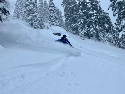
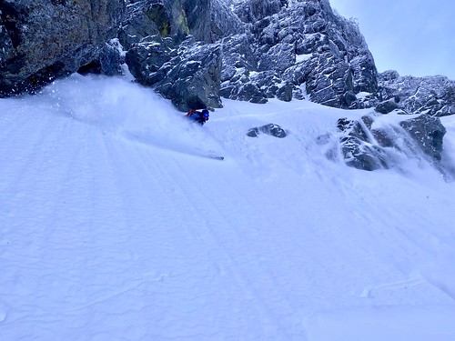


Photos
Below are photos taken over the years around Snoqualmie Pass. These photos focus on showing the terrain around Snoqualmie Pass with the intent of helping plan ski tours for areas you may not be familiar with. Use the map button (photos are also plotted on map above) to see the location plotted on a map. Direction refers to the direction the photo was taken, not in reference to any feature in the photo.


