
Stormy Mountain
Chelan,
Washington
Overview
Stormy Mountain is one of the higher peaks around the lower region of Lake Chelan and provides some fun ski terrain, including steeper northern aspects and mellow slopes coming off the summit towards Devil's Backbone. Stormy Mountain can be approached from both Lake Chelan and Entiat River Valley. Accessing from Twenty-Five Mile Creek in Lake Chelan requires a snowmobile, as the forest service roads which provide access to Stormy Mountain are high in elevation and don't melt out until late in the season.
Access from the Entiat River Valley is possible without a snowmobile. During the winter months it will require a long approach on forest service roads, while in the early spring, with the right timing and conditions you may be able to drive close enough on forest service roads for a reasonable day trip. From Upper Preston Creek Forest Service Road 5502, take the spur Forest Service Road 5502-216, and at the first major switchback leave the road and attain the ridge just to the north - note, the bottom section of the ridge can be thick with trees and alder, however it does open up the more you progress up the ridge. Follow this ridge all the way up to the northwest flank of Stormy Mountain, and then head southeast to reach the summit. Ski back down the northwest flank towards Devil's Backbone, and ski the western slope just north from the ridge you ascended on. Depending on snow coverage, you may be able to ski that aspect all the way into the valley, otherwise, traverse over towards the ridge and begin the arduous exit through trees and alder back to Forest Service Road 5502-216.
Directions
Parking
Trip Reports
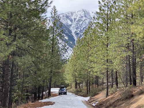
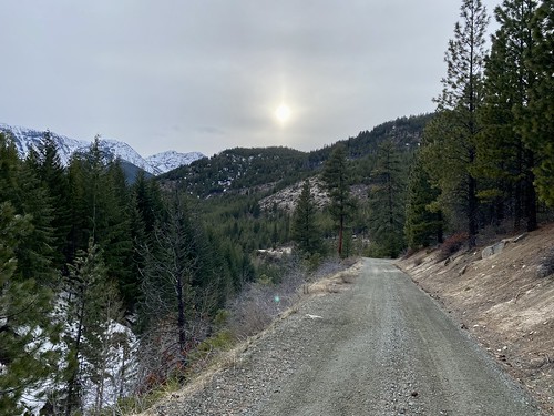
Over at Outdoor Wenatchee I had read a trip report about skiing Stormy Mountain, as well as Angle Peak, from Entiat Valley and decided to give it a whirl. I had intended to venture up into the Entiat River Valley a little earlier in Spring, but obligations and my family vacation to Greece meant it was mid April before the opportunity presented itself. My expectations were low and actual ski objective unknown, as I was unsure about both the snowpack and how far up the road I could drive. I started encountering snow patches in the road around 2,400 ft and around 2,600 ft I ran into a series of snow patches on an uphill section which I couldn't plow my way through. A number of attempts later, which included a fair amount of digging with my avalanche shovel, I was able to punch through the snow and make it a little ways further. The snow on the road was becoming more consistent and it looked like this was the proverbial end of the road for driving.
I consulted the map to determine where I was, and see if a ski tour was even realistic, or at least if I could get in a ski tour that would be more than skinning along forest service roads. I had ventured off Preston Creek Road onto Upper Preston Creek Road, which meant Angle peak was out of the question. Either Devil's Backbone or Stormy Mountain seemed like a possibility, and given the amount of effort I had already put in with the shoveling, I decided to try and make the most of it.
I started skinning up the road and after the first large turn, the snow ended. Fortunately, it was a short walk before I encountered snow again, and I threw the skis back on. There was at least a foot of snow on the road now, and there was starting to be consistent snow in the forest, although it wasn't deep enough to venture off the road yet. I reached a fork in the road, and after consulting the map again, decided to take 5502-216, as that looked like the most direct road.

I came to a major bend in Forest Service Road 5502-216 and had to decide whether to head off the road and make a direct shot up the mountain, or continue following the road as it traversed along the side of the mountain slowly gaining elevation. With the snowpack improving and anxious to start gaining elevation, I left the road and made my way towards a drainage just north of me. Once in the drainage, skinning proved to be tough. There was a mixture of close trees and slide alder, and the slope continued to steepen, forcing me to head up to the ridge in hopes of easier skinning.

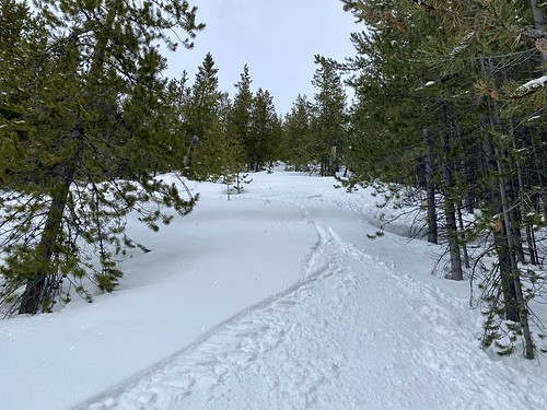
The forest opened up a little bit on the ridge, but not much. And now I was dealing with snow sticking to my skins, and of course, I didn't bring any skin wax. There had been new snow overnight at higher elevations, and in the afternoon warmth, that snow was very wet and sticking non stop to my skins. I kept progressing up the ridge, trying desperately to knock the snow off my skis every so often. While the trees had opened up on the ridge making navigating easier, the constant battle with snow sticking to my skins made for dreadful skinning.
At around 4,800 ft after taking a short break, I decided I would bootpack instead of skinning. Which was a big decision for me, as I generally refuse to bootpack if skinning is an option. Skinning a steep slope with numerous kick turns or bootpacking - skinning wins every time. But it felt like I had 30 pounds extra weight on each foot, and there was a solid crust below the couple inches of new snow, so I bit the bullet and threw my skis on my pack and started booting.

Around 6,300 ft, I threw the skis back on, as the snow seemed a little less moist and I was sick of bootpacking. Through the trees I caught glimpses of the slope to the north, and it looked like it might be a decent ski. My plan was to get to the top of this ridge, and then potentially ski down, abandoning the idea of summiting Stormy Mountain. I had been to the summit already in the fall during a hike with my family, and the skiing off the summit, at least on this route, didn't look especially thrilling.
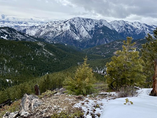
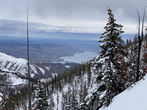
I had a couple of minutes of blissful skinning before the snow started sticking to my skis again. It didn't seem as bad as earlier, or maybe it was just better than bootpacking, so I kept skinning up. Upon reaching the top of the ridge, I could see down into Lake Chelan Valley, and my spirits lifted. I could see the Grouse Mountain ski tour I did earlier in the year, as well as Lake Chelan. I was about 800 feet from the summit of Stormy Mountain and knew I would be kicking myself if I didn't make it to the top.
I continued up the western flank of Stormy Mountain, and quickly began questioning my decision to continue on - the trees were thick, making it a pain to skin through and I had huge amounts of snow sticking to my skins. But with less than 500 feet to go, I decided to take a nice long break, eat a bunch of food and then push through to the top. The trees were opening up a bit, and the snow quality seemed much improved from lower elevations.
After starting skinning again, I realized the snow wasn't sticking to my skins anymore. The nice long break in the cold temps must have helped, as did the light dry powder which I was skinning through. And to top it off, there was a nice opening through the trees for easy skinning. I was tired, but now felt confident about making the final push to the top, stopping occasionally to enjoy the views of Lake Chelan and the surrounding mountains.

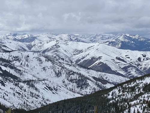
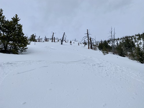
It was a bit windy at the top, and while it had been snowing on and off for the later half of the tour, it had picked up recently, but visibility was still good. I quickly transitioned to ski mode, and headed down along my skin track. I was pleasantly surprised to find the clearing I had followed up at the top continued all the way down to Devil's Backbone and it was actually a fun ski. The terrain was mellow, but it was open and the snow was great. About 6 to 8 inches of fluff and I wasn't hitting any sort of crust with my turns. Upon reaching Devil's Backbone,, there was a nice open slope dropping into the valley below me. During my skin up, I had never been able to get a good look at this slope, and had been expecting to ski my skin track back down the ridge, which wouldn't have been a particularly nice ski.
After enjoying turns down the open slope, I eventually started making my way over towards the ridge I had come up. It looked like I could ski down farther in between some rock formations, but I was concerned I would run out of snow, and then have to come back up the slope. I was able to find some occasional open runs through the trees, and mixed in some traversing where appropriate. The snow was pretty heavy at this point, but it still skied pretty well. Once in the drainage, it looked like I might have been able to ski the original slope all the way down - oh well, I'll give it a try next time.

I made my way down to the bottom of the drainage, but quickly decided that wasn't going to be a good option. It was quite constricted, with fallen logs and holes in the snow. I proceeded to traverse down the slope, through the thick trees and alder. It was not a pleasant experience, and it took me a while to get down 600 ft to the bottom of the drainage.

Once at the bottom of the drainage, it was smooth sailing. I followed my skin track back to the Forest Service road. It had felt relatively flat coming up, but had enough of an incline that I was able to cruise out without a lot of extra effort. I had to take my skis off once to follow the bare road, and then it was skis back on and back to the car.
Considering it was a brand new area for me, and I was unsure what to expect with snow coverage and road conditions, things worked out pretty well. However, the skin up wasn't particularly fun once leaving the road. After dealing with the thick trees and slide alder, I had to deal 3,000 ft. + of vertical with snow sticking to my skis and bootpacking and definitely considered bailing out. I'm glad I didn't, as the ski down was much better than expected and made it all worthwhile.