
Skyline
Stevens Pass,
Washington
Overview
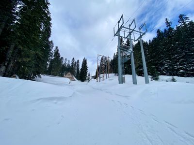
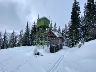
The Skyline area provides a variety of different short skis just south of Skyline Lake. With mostly treed slopes, it's a popular area for beginner to intermediate ski tourers, or those with time constraints. The ascent follows a forest service road, which can be accessed from Stevens Pass Ski Area parking lot G or C, up the side of the mountain. To access the forest service road, make your way through some cabins and underneath the power lines. Skiing options, like Short N Sweet and Highway Chutes, begin after reaching the radio tower and continue as you progress up Skyline Ridge. After your descent, you will skin out on the snow covered Tye Road back to the Steven Pass Ski Area parking lot.
Directions
Parking
Trip Reports
On my way up north to ski Journeyman Lodge in British Columbia, I decided to get a quick ski tour in at Stevens Pass. Short on time and with mediocre conditions, I opted for a super quick ski in the Skyline area, my first ever in this spot. Given it was a non powder week day, I was able to find a parking spot fairly easily in lot C. I made my way up through the cabins and quickly spotted the forest service road.
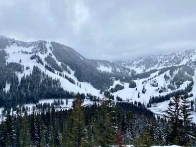
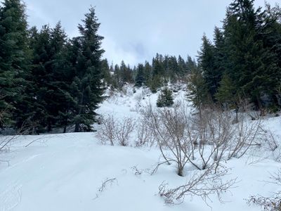
The road up was groomed, with tracks from both ski tourers and snowshoers. I ended up passing a group of snowshoers farther up the trail, but didn't see any other folks skiing during my outing. Views of Stevens Pass Ski Area part way up the trail reminded me of how bad a ski season we were having - there was underbrush and small trees visible on some of the steeper slopes.
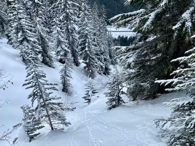
Upon reaching the radio tower, I left the road and took a quick look around to check out the slope below. The trees looked a little thick, so I decided to progress up a bit further to check out the Highway Chutes.
The descent looked a little more open farther up, and I decided to transition to ski mode and make my way down. The snow was a little better than expected, with some powder in the undisturbed spots. However, as I made my way down the top part, there were a number of older slides and the avalanche debris was difficult to ski through.
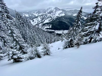
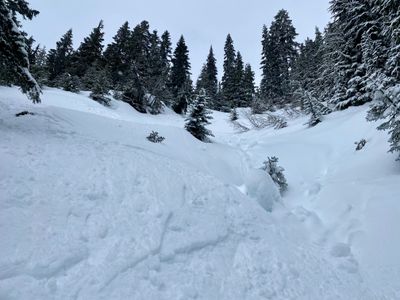
As I descended down the run, the skiing became more difficult. The chute didn't have a lot of snow in it, and while parts were skiable, there were openings in other locations. The sides of the chute still had slide alder popping up in places, and farther over on the slides were thick trees. I was able to link some turns together, but it was certainly not a fluid ski.
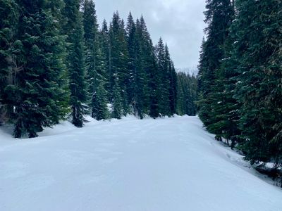
Towards the bottom, the slope mellowed and it opened up a bit and I was able to link together turns through the slide alder before reaching the snow covered Tye Road.
I threw the skins back on and made my way up Tye Road, and eventually ventured off into the forest towards the parking lot when the road turned. Since I had parked in lot C, I skinned around to the pedestrian bridge, and then walked back to my car.
While it was nice to get out for a quick ski tour, it certainly wasn't a great ski, as the low snow year made it difficult to find consistent open space to ski down.