
Yodelin
Stevens Pass,
Washington
Overview
Yodelin is a popular area at Stevens Pass, both for beginner ski tourers as well as during heightened avalanche danger, as it provides a mix of moderate and lower angle slopes with both spaced trees and open areas. A little less than two miles east of the Stevens Pass Ski Resort, Yodelin opened as a ski area 1969, but a tragic avalanche across the street in the Yodelin residential area led to its closure in 1974. Hence, you will find the remanants of old ski runs and lift tower bases.
From the parking lot, head just south of the building to connect to an old overgrown road and continue to follow as it winds up the slope towards the top of the ridge. There are a number of runs off the ridge, including Shakedown and Center Bowl, and from the saddle you can head northeast along the ridge to access some treed runs like Big Trees down the front, as well as runs like Backside Glades down towards Mill Creek. If proceeding down the backside, you will need to skin back up to the saddle.
Directions
Parking
Trip Reports
I arrived at a virtually empty parking lot. There were four other cars in the lot, and given the copious amounts of frost on the vehicles, it was clear they had all been here overnight. As this was surprisingly my first time to Yodelin - it has been many years since I backcountry skied at Stevens - I had to double check that I pulled into the right lot. It all became clear why the lot was empty as soon as I hopped out of the car. It was a brisk 5F and who in their right mind would show up at Yodelin at sunrise on one of the coldest days of the year?
I quickly assembled my gear and started heading straight up from the car to a road grade above me. I should have paid more attention to approach, as a couple hundred feet later I was wrestling through slide alder on a steep slope. Using some veggie belays, I was finally able to get through it and continue along my way, but made a mental note to not attempt this again in the future, and instead skin up on the south side of the building.
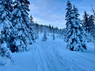
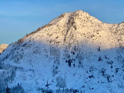
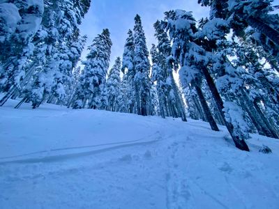
Back on track, pun intended, I followed the well worn skin track as it wound its way up the mountain, and enjoyed nice views of Lichtenberg Mountain and Moonlight Basin. Just as my hands were warming up, I had to stop and take some photos…
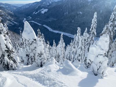
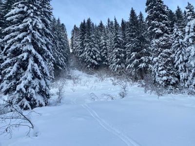
I continued cruising up the skin track, with nary a sight or sound of anyone else on the mountain. Given the lack of snow in the season, I had been expecting a lot more people, although some folks may not have had MLK day off. I topped out near point 5023 and decided to head down into the saddle and then up the ridge to access Backside 1, as I wanted to check out the backside of Yodelin and that particular run looked to have the largest amount of vertical, descending down to Mill Creek.
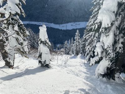
I traversed along the ridge and looked for some tracks heading down the backside. There was quite a bit of snow, and I was feeling lazy and didn't want to break trail back up to the saddle from Mill Creek. I finally found a track heading down and decided to drop in nearby. The top looked pretty tight with trees, but photos I had seen indicated it should open up lower down.
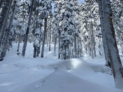
The snow was a little wind effected at the top, but I didn't see any signs of instability as I picked my way through the trees. With the deep snow, steeper slopes and tight trees, it was hard to establish any sort of rhythm and link up a good number of trees. I was beginning to regret my decision when I finally skied into a clearing. There was a little alder peeking up in the clearing, but not enough to slow me down, and I enjoyed some great turns down.
Towards the bottom, the alder became thicker and some creek beds more pronounced and it wasn't nearly as fun. I imagine a couple more feet of snow depth would have gone a long ways towards making this run more enjoyable from top to bottom, but I was able to link together some really nice turns for over 500 vertical feet.
While throwing on my skins, I noticed the tail strap had broken, and my hook had come out. Given the ultra cold temps, which can make the skin glue a lot less adhesive, I was concerned I might run into issues skinning back. Fortunately, it never proved to be an issue. I had a nice mellow skin track to follow and got a visual on some of the other runs on the backside like the Backside Glades and Yodelin Burn.
Once at the saddle, I headed northwest again along the ridge and finally ran into the first people of the day - there were a couple of groups skinning up along the ridge. I dropped in near Big Trees and had a fun ski down. Reaching a flat spot I mistakenly went right until I realized this was an up track and I was headed in the wrong direction!
I had to throw my skins back on, and after a little uphill, ripped the skins and started following a track back out. It was a fun day in a new spot - definitely reminds me of Kendall Trees at Snoqualmie Pass - an area I can hit when I'm solo and/or worried about avalanche danger and looking for a shorter tour!