
Wolcott Family Natural Area
Colchester,
Vermont
Overview
The Wolcott Family Natural Area is a 61.7 acre plot that is managed by the Winooski Valley Park District and opened to the public in 2018. It features a 1.5 mile loop trail winding through a variety of habitats, and has a number of wooden bridges across marshy areas and small streams, including Pond Brook. The trail can be hiked in either direction and is very well signed, and a short side trail for a wetland view.
Directions
Parking
Trip Reports
I woke up early and found myself with a couple of hours before my west coast work meetings started. There was a little blue sky showing through the clouds, so I quickly searched for a place to get out for a quick walk and settled on The Wolcott Family Natural Area.
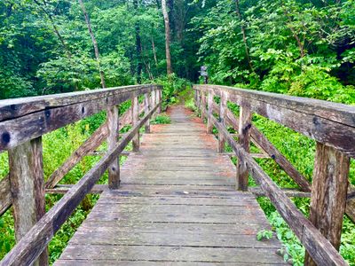
From the parking lot, the trail descends a short distance onto a small wooden bridge. A the end of the bridge was the start of the loop. I proceed to the right, or counter clockwise, for no other reason than I figured it was better to start with an incline, although it was a very short incline and this hike has next to no vertical gain.
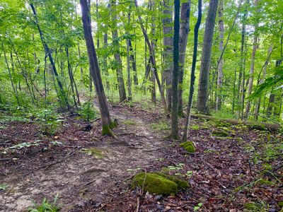
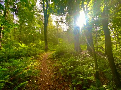
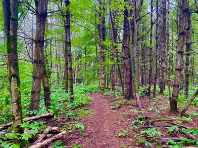
I followed the trail as it meandered through the forest, it was in very good shape and well marked, with small trail markers posted on trees along the way. The sun hadn't really come out as hoped for, however there wasn't any rain and the trail was in good shape, with minimal mud.
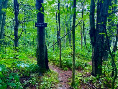
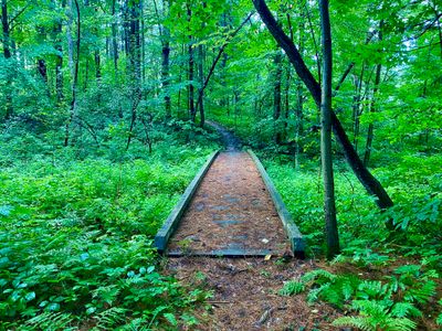
There were a number of wooden bridges crossing over streams and wet areas - it must have taken a considerable amount of work to put in. I can't remember how many I crossed, but I want to say there must be at least 10 of them in 1.5 miles. After less than a quarter of a mile, I came to a junction in the trail, with the signage indicating I could take a side trail for a wetland view. It was a very short side trail, and there wasn't much of a view, with trees and foliage blocking most of the wetland area.
Back on the loop trail, I found some blackberries and enjoyed a quick snack. The trail continued through a mixture of forest and marshy areas, with more wooden bridges over the wetlands. The sun made an appearance for a little while, but then the cloud cover came back. Fortunately, there was no rain on this hike.
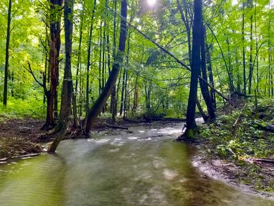
A little less than half way through the hike I came along the bank of a good sized stream, which I believe was Pond Brook. The rushing sound of the water combined with the chirps from the nearby birds had a very soothing effect as I snapped some photos of the brook. Fortunately, there didn't seem to be any mosquitoes bothering me either, unlike my previous hike on the Casavant Nature trail.
I upped my pace along the second half of the loop trail, needing to get back to my brother-in-law's house in time for a couple of work zoom meetings. One part of the forest almost looked like it had been burned, but I'm guessing it was some sort of insect infestation killing the trees rather than the wildfires I am used to on the east side of the cascade mountains.
I quickly finished up the remaining hike and made it back to the house in time for my meetings. I enjoyed the loop trail at Wolcott Family Natural Area. It's a short hike, but both the trail and the scenery are nice, and it's worth a stop if you are in the area.