
Reach 1 Trail
Chelan,
Washington
Overview
The Reach One trail, completed in 2010, comprises a couple of different sections, the first one being a half mile paved trail which starts near the boat launch and goes past the Chelan Dam. The trail then turns into gravel, and proceeds down to the Chelan River. There are a number of interpretive signs along the way, providing information about the history of Chelan. It's a great hike for families and is conveniently located 5 minutes outside of downtown Chelan.
You have the option of walking the entire trail by starting near the boat launch. This requires walking along Farnham Ave / Saunders St, and taking a left on E Raymond Street, where you will find the paved trail at the end of the street. Or start at the Chelan Butte trailhead to walk the gravel trail. Reach One provides access to the Eagle Trail, and Cutthroat and Coyote loop trails.
Directions
Parking
Trip Reports
The smoke from the Cub Creek 2 and Cedar Creek fires around Winthrop had dissipated, providing my first opportunity in the week to get out for a hike. Getting up early and making the 25 minute drive from Manson, I was able to get a nice, quick hike in before work.
This was my first time hiking the Reach 1 trail, and I was unsure where to park. I had seen some information indicating I should park at the Lake Chelan Public Boat Launch, while other sources mentioned parking at the Chelan Butte Trailhead. I opted for the Public Boat Launch, and had to walk up a couple of streets before I reached the trailhead for the start of the Reach 1 trail.
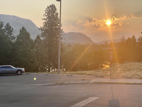

At the trailhead, I was happy to find an informational sign about the planet Uranus. The Chelan Riverwalk trail has signs for each planet, and my son really enjoyed learning about all the planets last summer over the course of a couple of walks on the trail; however we were never able to find Uranus. You can imagine my delight when I was able to text my wife “I have finally found Uranus”. Anyways... this section of the trail is paved, and there are a number of interesting Vignettes posted along the trail that provide great history about the area, as well as the dam, so it’s worth walking this section at least once.
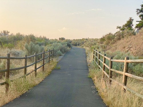

At the Chelan Butte Trailhead, the trail turns into gravel, although it is still quite wide. You parallel the road for awhile, before starting your descent towards the river. Interesting fact : Chelan River is the shortest river in Washington State at 4 miles long. There is an opportunity venture off on a side trail, but I opted to stay on the main trail and make my way down to the river.

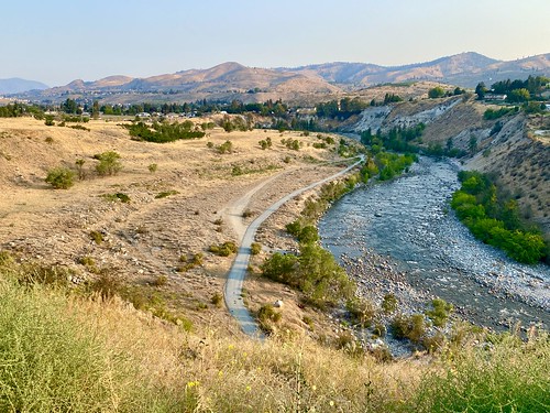

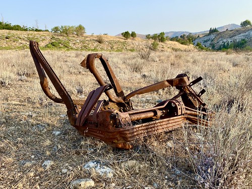
After ascending down into the Chelan River Valley, I noticed a number of hunks of rusted metal. Up on the hillside, it looked like the area might have been an old dump. I walked to the end of the trail and then took a nice break at the river. I can only imagine what the River was like prior to damning the lake and controlling the flow. The steep walls of the River Valley certainly gave an indication.
My final stats for the walk were 3.61 miles and 322ft of elevation gain. A great easy hike 5 minutes from Downtown Chelan, and one that I am sure I will take again.