
Pilot Butte
Bend,
Oregon
Overview
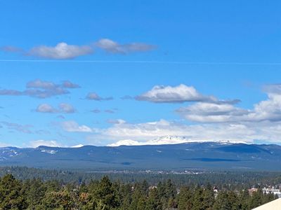
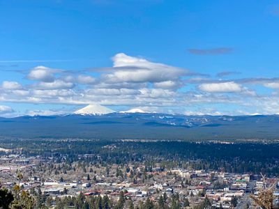
Pilot Butte is an small extinct cinder cone volcano located within the city limits of Bend, and provides sweeping views of the city, surrounding areas and the area's other more well known volcanoes like Three Sisters, Mt. Jefferson, and Mt. Hood. There are a total of four trails in the park : two trails that ascend to the summit, while the Base Trail circumnavigates the bottom of Pilot Butte and the Larkspur Trail passes through the park adjacent to the main trailhead.
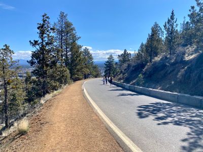
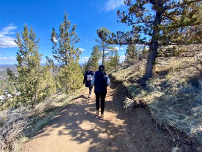
For hiking to the top, the Pilot Butte Nature Trail is a well maintained dirt trail which starts at the trailhead next to the parking lot and wraps around Pilot Butte up to the summit. The Summit Road Trail follows the seasonally closed paved road (closed during the winter and early spring) to the top and is accessed by starting up Pilot Butte Nature Trail and taking a left onto the Road Trail connector or via the Base Trail which intersects with the road on the southwest side. Many folks opt to go up one trail and down the other.
Directions
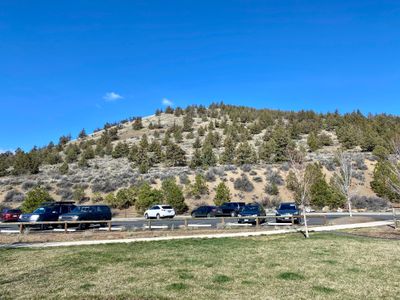
Parking
Trip Reports
With friends making the trip over from Portland to hang with us in Bend, we decided to get a little exercise on Sunday before they took off. Pilot Butte was the perfect option, located a quick ten minute drive from our hotel, and coming in at 2 miles and less than 500 feet elevation gain.
We walked over to the trailhead, and I was a little unsure about which trail we wanted to take. I knew there was a trail to the summit, but hadn't spent much time looking into the hike, and didn't realize there were a number of other options. Shortly after the trailhead, we took a left to follow Pilot Butte and then took another left on the Road Trail. It didn't look like there was any traffic on the trail and seemed like a nice way up for the kids and dog.
While there was room to walk on the shoulder of the road, it appeared the road was still closed for the season, and given the number of folks coming up and down, we opted to walk in the middle of the road. As we ascended, we were treated to views of the surrounding mountains and volcanoes. Not being from the area, there was much discussion and less consensus on what particular volcanoes we were looking at. We could identify a couple by referencing google maps, but it was strangely hard to figure out a couple of them.
We followed the summit road trail as it circled around Pilot Butte, occasionally stopping to wait for the kiddos to catch up, as there always seemed to be something off interest that caused them to slow down. The weather was great, although it was a bit windy towards the top, and I'm glad we brought jackets.
At the top, there was a nice open circle plaza area, with signage around the perimeter with information on the geology and history of the area. While one sign detailed the volcanic part, I was disappointed to not see a sign detailing all the different volcanoes we were looking at. I think we figured out most of them, but there was still some debate on a couple of them.
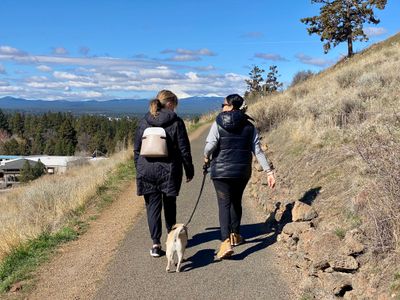
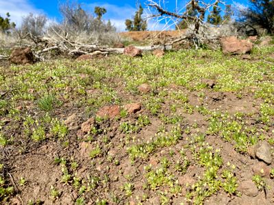
After soaking in the views, we started heading down and decided to take the Pilot Butte Nature Trail. The trail followed the same contour as the road and was in good condition, but it was nice to get off the pavement and feel like I was on more of a hike. We saw some flowers, but I was surprised not to see more wildflowers in bloom, given they were starting to come out up north around Lake Chelan. We were at a higher elevation in Bend, so maybe that delays things a bit.
We followed the trail down, only passing by a handful of other groups on their way up. Seemed to be less traffic than the Summit Road trail.
Back at the car, we said goodbye to our friends and headed back towards the hotel. Pilot Butte is a great family hike located within Bend - definitely worth doing on your next visit.