
Johnson Creek
Manson,
Washington
Overview
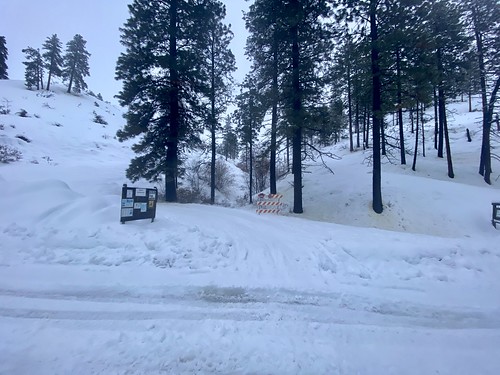
Johnson Creek is situated off of Lake Chelan right next to Antilon Lake Sno-Park. The Johnson Creek Forest Service Road 8213 follows the creek, and is often used by snowmobiles and provides easy access into the surrounding mellow mountains. It's suitable for snowshoeing as well as intermediate backcountry skiing with short runs when the snowpack allows. From the Antilon Sno-Park, head back down the road a short ways, and then on your left you will find the Joe Creek Forest Service road. Follow this until you see the Johnson Creek road on your left. You can also save some time by leaving the Joe Creek road at the first switchback and heading up the hill to connect with Johnson Creek road. The road will flatten out and proceed up the valley, and at the next major switchback you can continue following the road, or start heading directly up the mountain. Pick a slope to ski - all the slopes are of moderate angle, and covered in shrubs and small trees, so you should have the ability to get eyes on any slope you want to ski. Depending on what slope you ski, you can exit out the same way you came in, or exit via the drainage to the north.
Directions
Parking
Trip Reports
Looking at the weather forecast the night before, I knew it was going to be a gamble heading out in the morning for a ski tour around Chelan. As I walked out of my house at 7am into a steady rain and thick clouds, and noticed the car temperature gauge sitting at 36, I started to question my decision. I hadn't been in the Chelan Valley long enough to really dial in ski touring forecasts, and it was too late to figure out somewhere else to head. So I drove up the road, hoping higher elevation would bring better conditions.
I was the first one at the Sno-Park, and the drizzle seemed to be letting up. I started my approach, following a snowmobile track up Joe Creek road. The coverage looked pretty good, and at the first switchback, I decided to venture off the road and make my way directly up to Johnson Creek Forest Service Road, hopefully shaving off a little bit of time. Once on Johnson Creek Road, the snowmobile track was gone as they must have continued on Joe Creek, but the snow wasn't that deep and it was fairly easy skinning.
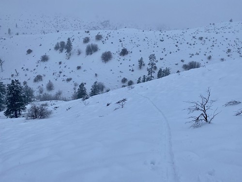
Johnson Creek Road didn't gain any elevation, but it progressed up the valley. I was anxious to get up higher by the time I reached the first switchback in the road, and decided to leave the road and start skinning directly up the mountain. The snow was wet, but not too deep, and again made for fairly easy skinning. As I progressed up, I could see some halfway decent ski slopes across the way.
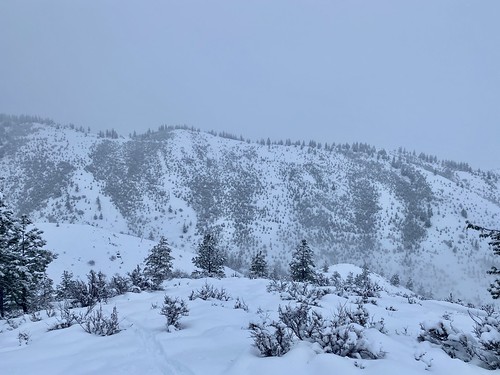
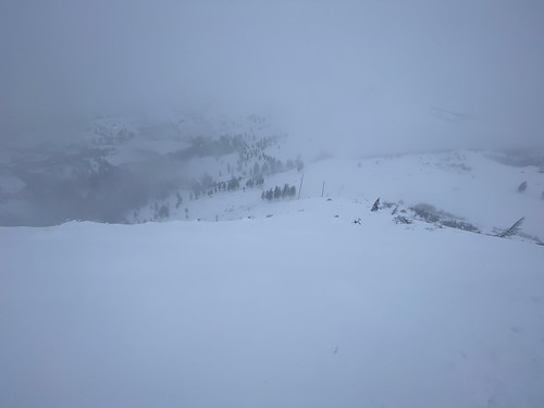
The good news, it was now snowing. The bad news, visibility was deteriorating and the wind was picking up. As I approached a ridge above me, I looped around the north side to get a visual on the slope and liked what I saw - it was a decent pitch, and had some "alleys" with minimal vegetation. I went a bit further up the ridge, but decided this would be my turnaround point and I would head down and ski the slope I just spied.
The ski down from the top part was actually pretty good. I was regretting not bringing my new GoPro I had gotten for Christmas. There was a good amount of new snow at this elevation, and while it was on the heavier side, it certainly wasn't anything I wasn't used to. While the visibility wasn't great, the light was decent and the surrounding shrubs provided some contrast.
I had an enjoyable ski down. Towards the bottom the snow definitely got heavier, and at the end I decided to traverse over, reaching another forest service road which would bring me back to Johnson Creek. This road had enough of a decline that I was able to make good progress.

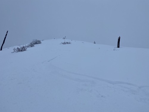
I was not looking forward to exiting on Johnson Creek road, as it would have been about 2 miles, with a lot of it pretty flat. There was a small knob in front of me that looked like it would provide a small but decent ski and allow me to exit out to Antilon Lake, where I could follow another much shorter road back to the car.
I skinned up the knob and as I was near the top, I noticed a nice short fairly steep pitch down to the bottom. Farther along it looked rockier and steeper, and while I hadn't encountered any concerns with regards to snow stability, I decided it was better to head down here. I didn't want to get on the side of a steep rocky slope in this wet snow, especially being solo - seemed like opportunity to get caught in a wet slide.
The ski down through wet and heavy snow was brief, but fun. Towards the bottom I again started traversing to shave off some distance, which in hindsight wasn't the best option. There were a number of small cliffs and rocks the farther over I went. I was able to find a way through, but I would have been better off skiing down the fall line to the bottom.
I skied out onto the road, and then followed the snowmobile tracks back to the car, passing by Lake Antilon on the way. All in all, the gamble paid off. I was able to get some decent turns in, and it is always fun exploring new areas. I'm already planning to get back to Goff Peak, and I think my exit route would be a good approach...