
Innis Arden Reserve Park
Shoreline,
Washington
Overview
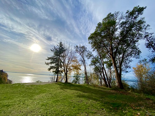
The Innis Arden Reserve Park is a small park tucked away along the Puget Sound in Shoreline, just North of Seattle. A public trail at the northern part of the park provides for a short hike down to the railroad tracks which run on the shore of the Puget Sound. You will be treated to pretty views along the way, especially from a cleared overlook look near the top. However, the trail is often in a bit of a rough state, with mud, standing water and blowdowns common. The Innis Arden Beach trail to the south, off 166th St, is a private trail with a locked gate blocking access and is only open to residents of the Innis Arden community, which traces its roots back to William Boeing, the founder of the Boeing Company.
Directions
Parking
Trip Reports
After my hike at Shoreview and Boeing Creek Parks, I decided to head over to Innis Arden Private Reserve for a quick hike down to the Sound. I had read reports that the Innis Arden Beach Trail off Northwest 166th street was not publicly accessible, and since I was right nearby decided to confirm this - there is a metal gate that is locked, and signage indicating it is not for public use. But the trail off of 15th Ave is open to the public.
There isn’t much space to park, but I doubt this trail gets much traffic. As I pulled in there was a couple exiting the trail with their dog and walked down 15th Ave, obviously living close by. There were a number of Lime bikes parked at the entrance, would be curious to know who rode the bikes here and then decided they didn’t need them anymore…


The trail gently descends a bit before you reach a wide open area with nice views of the Sound. From here the trail has a bunch of steep steps going down the hill, before it mellows out and descends at a more gradual pace. There were wooden planks along the trail that helped avoid the muddier spots.


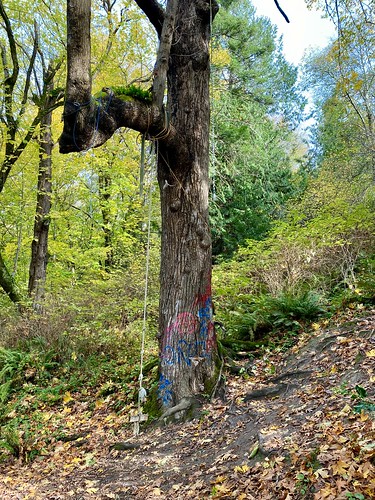
Towards the bottom there was a couple of blowdowns in the trail which I was able to get around. Right after the blowdowns I abruptly exited the forest and was at the train tracks, staring at the Sound. It looked like a trail may have continued south into the forest, but I didn’t feel like following it - it looked really muddy and who knows where it ended up. I crossed the tracks to take a quick look at the shoreline (not much to it besides rocks) and then headed back up to the car.


I'm glad I did the hike, but probably not something I will be doing again any time soon, unless I happen to be in the area and need to get some exercise!