
Crater Lake - Raven Trail
Crater Lake,
Oregon
Overview
Raven Trail is part of the network of ski and snowshoe trails in Crater Lake National Park that are open during the winter and spring months. It begins next to the Crater Lake Park Headquarters, and in a little over a mile brings you near Rim Village in the snow covered months, providing outstanding views of the lake. The first section of the trail parallels Rim Drive, then breaks off and takes a more direct approach up to the rim. While this is intended as a ski and snowshoe trail, it may be your only option up the rim to view the lake in the event the upper section of Rim Drive is closed to traffic. While Rim Drive is usually open up to Rim Village in the winter, closures do happen.
Directions
Parking
Trip Reports
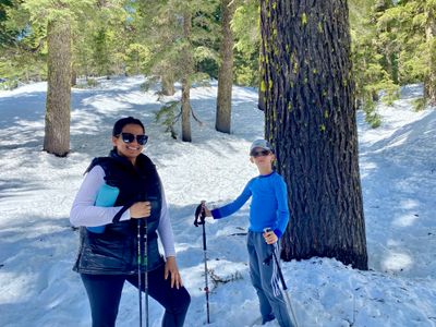
The original plan had been to drive from Bend up to Rim Village, take in the lake and hopefully get the family do a short, flat ski tour along the snow covered road for some exercise (it would be my 9 year son's second time ski touring). However, a couple of days prior, I checked the national park website and saw that Rim Drive was only open up to the park headquarters / visitor center. I called the park, and they indicated there was a short trail, but with moderate elevation gain, that would take us up to the rim for views of the lake. After a quick conversation with my wife, we decided to go for it with the plan to skin up the trail.
At the entrance to the park, the ranger indicated the trail was steep and difficult, spooking my wife. I wasn't about to turn around after the 2 hour drive, so we headed up towards the park headquarters. We went into the visitors center and spoke with another ranger about the trail, and came away feeling better. There was a decent amount of elevation gain, but many people were hiking the trail, and there weren't any steep exposed sections you hiked along - there was an steeper avalanche slide path above the trail, but the trail briefly passed through the bottom and avy conditions were moderate. The temps were warm, and the snow super slushy, and I opted to ditch the touring gear and go on foot, as the ski down would have been challenging for me, and extremely difficult for my wife and son.
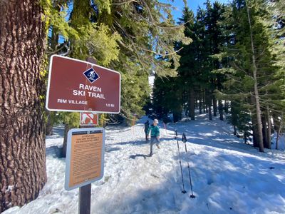
Across the road from the visitor center we located the sign for the trail and climbed up the snowbank and started following the tracks. Given the elevation and time of year, it wasn't surprising to be walking what must have been 10 feet of snow. It was slow going on the trail, but wasn't too bad as long as you stayed where there were numerous footsteps. If you ventured off to the side, you were likely to posthole up to your knees…
It was quite warm out, with temps in the 70's in Bend and in the high 50's in the park; however the trail was predominantly in the forest making for a pleasant hike. We quickly passed below the slide path off Garfield Peak the ranger mentioned, and it looked like the slope above would be a fun ski in the right conditions. Today the snow was quite mushy by the time we had arrived, and skiing would have been challenging on any aspect.
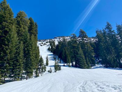
After being mostly flat, the trail started to gently ascend through a gully. There were a couple of short somewhat steep sections, but the only thing difficult about the hike was the fact we were walking on snow, which made it slow going.
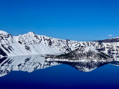
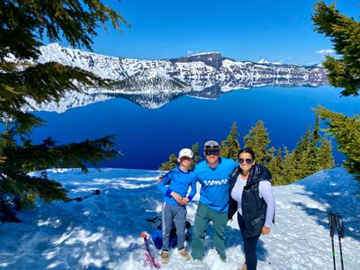
Exiting the forest, we came up on the rim and then looked for a nice place to have a rest and take in the view. There were probably around 20 to 30 people scattered around and it was easy to find a spot slightly off the trodden trail with great views of the lake. I had brought my shovel, and used it to quickly dig out a small platform to sit down. The lake was very calm and it was beautiful in the sun and snow.

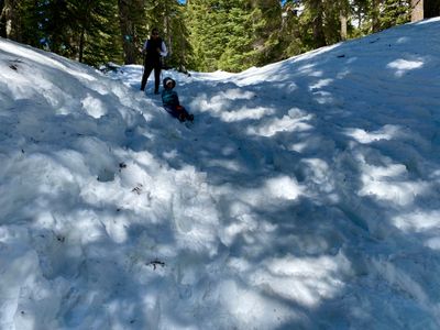
After a nice break at the rim, we began the descent down. It was a little more challenging heading down, and we had to pay close attention to the downhill sections in order not to slip and fall. I tried to have my son glissade down the steeper parts on my shovel, but it didn't work very well, as it was very bumpy snow due to all the footprints.
We made it to the bottom without anyone wiping out on the trail. While it would have been fun to drive up to the rim and then do a ski tour along the snow covered road, this was a fun adventure. While the park wasn't empty, there weren't that many people there and it's a nice time of year to check out Crater Lake National PArk - the bluebird day didn't hurt either!