
Chittenango Falls
Cazenovia,
New York
Overview
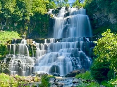
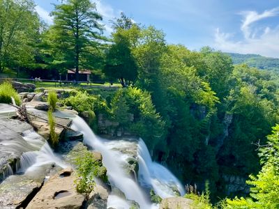
Located in a state park, the Chittenango Falls are viewable from the top via a short walk from the parking lot, as well as a nice short trail which descends down into the gorge and provides an incredible view of the 167 foot cascading falls. The gorge trail, which is a loop that can be taken in either direction, does have a little elevation involved, as you quickly descend to the bottom of the falls via a series of steps, but it's worth the effort for the splendid views from the bottom. The gorge trail is closed during the winter, and in the summer months the falls may have lower water flow (there was ample water when we visited in August).
Directions
Parking
Trip Reports
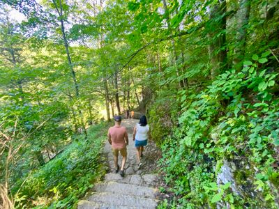
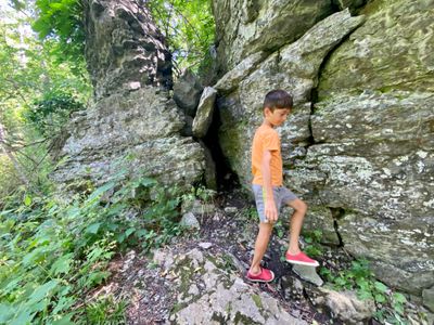
After recovering on Saturday from a red eye flight from Seattle to Syracuse, we hit up for some awesome beer and wings for lunch, and then proceeded to Chittenango Falls State Park. While the top of the falls are visible from a platform not far from the parking lot, we opted to take the short but steep gorge trail for a better view (my son required a bit of cajoling, but eventually agreed).
The trail starts near the parking lot, and quickly descends down towards the falls and river. It is fairly steep, but is well maintained with lots of rock steps on the steeper parts. While you could hear the falls, the dense foliage and hillside kept it hidden for most of the hike down.
Towards the bottom provided the first view of the falls, and then shortly thereafter we came down to the river, and were treated with spectacular views of the falls. There were a couple of people soaking in the river, which apparently you are not supposed to do... Anyways, we proceeded onto the bridge to get a direct view of the falls and snapped some photos.
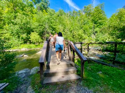
After admiring the falls for a bit, we continue along the bridge to the other side and started the hike up. The other side seemed slightly less steep, but we were still huffing and puffing as we ascended up the trail. The trail eventually leveled out and started to wrap around towards the top of the falls.
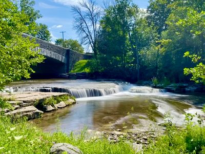
We were treated to views of the top of the falls, and while pretty, it wasn't nearly as cool as seeing the full 167 feet of the falls from the bottom. Before walking across the bridge back to the parking lot, I stopped to take a couple of photos of some mini falls near the bridge.
It's a short hike, but had an incredible view of the falls and was perfect for our family and friends. Highly recommend it if you are in the area.